![]()
GEZER
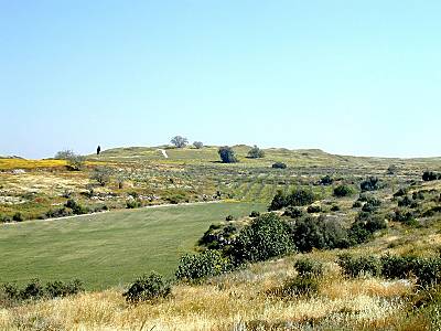
Gezer is located on the ridge of the Judean foothills about 7 miles southeast of Ramla. It is located at the junction of the Via Maris (the ancient coastal road that leads from Egypt up through Palestine and into Lebanon and beyond) and the road leading eastward across the Valley of Ajalon and onward to Jerusalem and Jericho. Thus Gezer occupied a strategic position in ancient Palestine. The tell, about 30 acres in size, also has a perennial water supply from nearby springs and wells at the southeast of the mound. All these features made Gezer an important location for settlers.
 Gezer has been excavated several times since 1902-the most
recent expedition under the supervisor of William Dever in 1984. These combined
excavations have yielded at total of twenty-six strata . The earliest settlement dates
back to ca. 3000 BCE and the site was more or less continually occupied until 100 CE. It
contains numerous examples of monumental architecture, walls, tombs and other artifacts.
Inscriptions were also found in large number at Gezer including one of the earliest known
Hebrew inscriptions, the so-called "Gezer Calendar" (a school tablet recounting
the agricultural season in ancient Israel), several stamped jar handles, and cuneiform
tablets. Gezer is mentioned several times in the Bible and is referred to in many other
ancient Near Eastern inscriptions. Ten of the Amarna letters from the 14th century were
written by kings of Gezer to the Egyptian Pharaoh. In the famous "Merneptah Stele
(ca.1208 BCE) recording the Egyptian conquests of Canaan, often associated with the
Exodus, Gezer is mentioned as one of the captured cities.
Gezer has been excavated several times since 1902-the most
recent expedition under the supervisor of William Dever in 1984. These combined
excavations have yielded at total of twenty-six strata . The earliest settlement dates
back to ca. 3000 BCE and the site was more or less continually occupied until 100 CE. It
contains numerous examples of monumental architecture, walls, tombs and other artifacts.
Inscriptions were also found in large number at Gezer including one of the earliest known
Hebrew inscriptions, the so-called "Gezer Calendar" (a school tablet recounting
the agricultural season in ancient Israel), several stamped jar handles, and cuneiform
tablets. Gezer is mentioned several times in the Bible and is referred to in many other
ancient Near Eastern inscriptions. Ten of the Amarna letters from the 14th century were
written by kings of Gezer to the Egyptian Pharaoh. In the famous "Merneptah Stele
(ca.1208 BCE) recording the Egyptian conquests of Canaan, often associated with the
Exodus, Gezer is mentioned as one of the captured cities.
Take me to the Gezer so I can begin digging
Take me back to the Map of the Region